Iron Roads Across the Red
Cross Hanoi’s working bridge between trains, farms, war, and water
- Hanoi, Vietnam
- 9 stops
- 427 min
- 31.1 km
- History
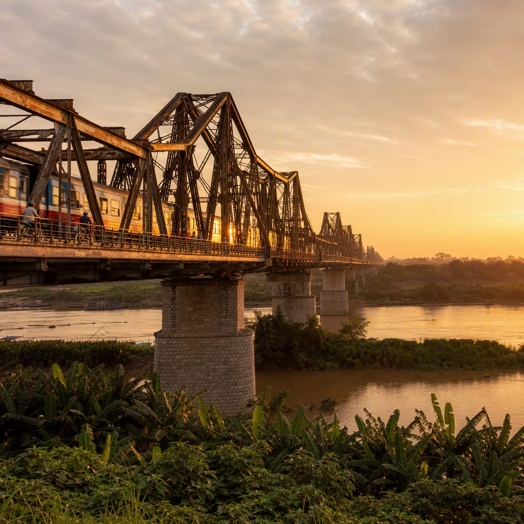
Try the first stop
Long Biên Market
Hanoi’s produce supply chain surges beneath the bridge before sunrise.
Begin where Long Biên’s transport story feels most alive. Trucks unload fruit, vegetables, flowers, and ice while porters steer handcarts through tightly organized lanes. The market reveals how the bridgehead still feeds Hanoi’s daily economy, linking railway history with the unseen labor behind neighborhood markets and street-food kitchens.
The route
9 stops, in order.
- 1Stop 1 · Free sample
Long Biên Market
Hanoi’s produce supply chain surges beneath the bridge before sunrise.
 Stop 2
Ceramic Mosaic Mural
Colorful ceramic history transforms Hanoi’s practical Red River flood wall.
 Stop 3
Long Biên Station
A working station sends trains directly onto Long Biên’s central track.
- 4Stop 4
Western Bridgehead
Steel, trains, motorcycles, and pedestrians converge at the bridge’s dramatic portal.
 Stop 5
Original Western Trusses
Riveted iron geometry reveals the immense forces carried across the floodplain.
- Stop 6
Wartime Replacement Spans
Mismatched steel sections preserve a visible record of bombing and reconstruction.
- Stop 7
Red River Overlook
The broad main channel reveals the river’s power, sediment, and seasonal moods.
- Stop 8
Bồ Đề Dike
An elevated riverbank road connects flood defenses, gardens, and eastern-bank life.
 Stop 9
Gia Lâm Station
A spacious rail junction carries Long Biên’s story into northern Vietnam.
The app guides you from stop to stop with GPS and plays each story when you arrive.